
Google 3D · Field guide
How 3D helps us explore places, art and the built world
Find the right entrance on a map, look around a real shop or walk through a building that hasn’t been built yet. Each experience uses a different way to show space.
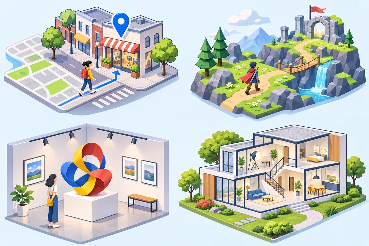
What’s the difference between a 360° tour and a 3D model?
360° photography
A panorama records what a place looks like from one camera position. You can look in any direction. A connected tour links several positions so you can step from the storefront to the entrance and into the rooms beyond.
3D models
A 3D model represents shapes and surfaces in three dimensions. You can view it from different positions, including angles beyond the original camera position. A model can be designed from scratch or reconstructed from captures.
Maps & virtual visits
Google Maps Street View and 360° virtual tours
Google Maps Street View lets you look around from street level and explore some interiors. Before a visit, check which side of the building has the entrance, how a storefront looks from the sidewalk or how the lobby connects to the main room. For a restaurant, a tour can help someone decide where to meet friends. For a showroom, it can show how departments are laid out.
Google Earth offers a broader view with 3D terrain and buildings in covered areas. Where available, Google Maps’ Immersive View for routes lets you preview a route before you leave. Its separate Immersive Navigation feature uses a 3D view to show surroundings such as buildings, overpasses and terrain while driving.
Google Maps Street View help · Google Earth · Immersive View for routes · Immersive Navigation
Walk from the sidewalk into Linden Court Café
Drag to look around. Follow the arrows from the sidewalk to the entrance and into the café.
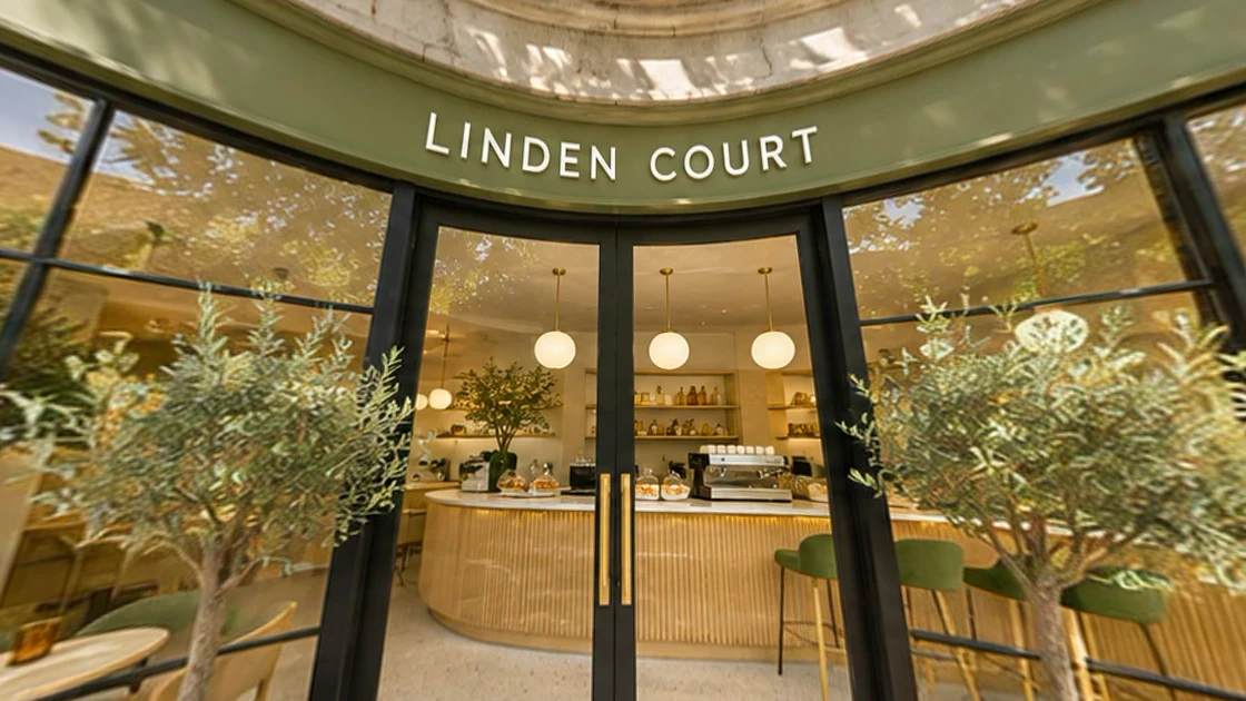
Find the front door from the sidewalk. Use the buttons to change views.
Gaming
Build worlds players can move through
Game designers use 3D environments to let players choose their path, look behind objects and see characters from changing angles. A team might block out a level with simple shapes first to see whether a bridge is easy to spot or a shortcut feels worth finding.
Digital art
Explore an artwork from every side
A digital sculpture can be rotated to reveal details hidden in a front view. A gallery can use a 360° tour to show how a physical exhibition is arranged, or build a 3D gallery to test new layouts before installing the work.
Architecture
Walk through a design before it’s built
An architect can use a 3D model to compare layouts and sightlines before construction. A 360° photo tour can document an existing site so the team can revisit the rooms visually between visits. Use measured drawings or a survey when dimensions matter.
Google Maps Platform & Google Earth
Explore a city in 3D or build a map for your own project
Street View is useful when you want to look from the pavement toward a doorway. An overhead 3D view answers a different question. It can show how a building sits on a slope, how a bridge crosses a valley, or where a proposed project fits into the neighbourhood.
Google Earth Studio
Animate a camera over Google Earth imagery in a browser. A geography lesson might start above a watershed and follow the river to a city. Google provides guidance on imagery attribution and permitted uses.
3D Maps and Photorealistic 3D Tiles
Developers can use 3D Maps in the Maps JavaScript API for an interactive web map. Google’s Photorealistic 3D Tiles provide a separate way to render textured terrain and buildings using a compatible renderer. A planning explainer can add its own annotated route or proposed site to help readers orient themselves.
Google Earth Studio documentation · 3D Maps developer guide · Map Tiles API
Architecture, engineering & infrastructure
From a building model to a map of the surrounding site
A 3D design model can show a proposed entrance and how it connects to the ground floor. A building information model (BIM) can add information about its components, such as door types, mechanical equipment and materials. A geographic information system (GIS) brings in location-based data such as terrain, parcel boundaries, roads and utility records.
Consider a station renovation. A designer can model the lift, stairs and concourse in BIM. A GIS map can show how passengers approach from sidewalks and bus stops. A public 3D visualization can combine approved views to explain the work. Before making design or excavation decisions, the team still needs the relevant surveys, engineering records and field checks.
A digital twin connects a model to information that changes over time. For a facility, that could mean linking equipment locations to inspection and maintenance records. A usable twin needs a clear update process so operators can tell when a model or record was last checked.
Augmented reality & digital art
Place a 3D object in a real room
Augmented reality (AR) shows digital objects over a camera view of the physical world. A gallery could let visitors place a digital sculpture in their own room. A designer could show a proposed reception desk at a consistent scale so someone can walk around it and assess the proportions.
Google’s ARCore helps supported apps track a device, understand features of the surroundings and estimate lighting. For a web-based preview, <model-viewer> can display an interactive 3D model and offer AR on supported devices. A regular drag-to-rotate view gives readers another way to inspect it.
For digital art, pay attention to the object’s scale, texture and lighting. A gallery piece that looks convincing on a desktop can load slowly on a phone. Try a lighter GLB export and check it on a real device before publishing. For photographed artwork, confirm that you have permission to publish the capture and any textures used.
ARCore fundamentals · Model Viewer examples · Khronos glTF and GLB
Software & workflows
Choose a 3D tool by what you need to deliver
| Tool | Best fit | Example project |
|---|---|---|
| Blender | Mesh modelling, materials and animation | Create a digital sculpture and export a lighter web model. |
| SketchUp | Early spatial and architectural concepts | Compare two café layouts with different seating and counter positions. |
| Autodesk Revit | Building information modelling | Coordinate architectural and mechanical models for a renovation. |
| QGIS | Spatial analysis and map layers | Compare terrain, parcels and access routes around a proposed site. |
| CesiumJS | Browser-based 3D geospatial scenes | Show a georeferenced corridor or a 3D city dataset on a globe. |
| Google Earth Studio | Camera animation over Earth imagery | Make a flyover to explain the relationship between a town and its landscape. |
| Google ARCore | Augmented-reality app development | Anchor a digital exhibit in a physical gallery. |
Start with one thing someone should be able to do. For a visitor checking what a shop looks like, linked 360° photographs are often enough. For a design team comparing proposed geometry, start with a model and an agreed level of detail. For web viewing, test a glTF or GLB asset on a phone before scaling up.
This is an independent guide. References to Google products link to Google’s documentation.
Show customers around your business
Google 3D is an independent photography service. We use a high-quality 360° camera to capture storefronts and interiors on site. Choose the areas you want photographed and review your package before choosing a time.